
THE HISTORY OF THE FAKE LOWER LAKES
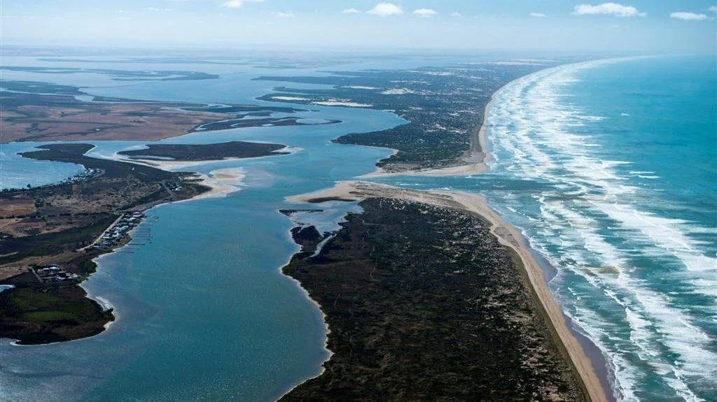
The so-called Lower Lakes are not natural freshwater lakes. Historically, they were a tidal estuary, shaped by the natural push and pull of the Southern Ocean and periods of low or no river flow. That is a matter of record, not opinion.
For decades now, vast volumes of freshwater have been forced down the Murray to hold these lakes at an artificial level. That water is stripped from productive communities upstream in Murray, undermining farms, jobs and regional economies to maintain an environmental outcome that does not reflect the river’s natural history.
This policy has come at a huge social and economic cost, with little evidence it has delivered the environmental benefits promised. Maintaining the Lower Lakes as permanent freshwater bodies has increased salinity pressures elsewhere, damaged river health upstream, and driven water recovery that hollowed out food-producing regions.
We need to be honest about what the Lower Lakes are, how they functioned naturally, and whether continuing this approach makes sense. Restoring the system to a more natural estuarine state would relieve pressure on the Murray, protect productive water in Murray, and allow for a more balanced, science-based approach to river management that supports both the environment and the communities that depend on it.
500,000 years ago
The sea begins retreating from the Victorian border, forming a series of parallel “old Coorongs” at varying elevations, tilting northward toward the modern Coorong and Lower Lakes. These ancient lagoons facilitated natural freshwater flows from wetlands covering up to 50% of the South East region, recharged annually in winter. There were no defined rivers discharging to the sea below the Murray Mouth until the Glenelg River in Victoria.
1863
First drainage works commence in the lower South East near Millicent and Port MacDonnell to manage waterlogging for agriculture and improve transport. Fresh water overflows the natural impediment at Tilley Swamp for five months, highlighting elevated wetlands slowly discharging into the Coorong via groundwater.
Pre-1840 (Pre-European settlement)
The South East is a mosaic of freshwater and saline wetlands (44–50% coverage), with large volumes of fresh groundwater and surface flows from the unconfined aquifer entering the Coorong at multiple points, including Salt Creek, Blackford Drain area, and near Bumyerie Island. This sustains multiple ephemeral ocean openings in the Southern Lagoon during winter, maintaining a freshwater–marine interaction without Murray River influence (no Murray diatoms found pre-European beyond Long Point).
Lake Alexandrina is estuarine and often salty, while Lake Albert remains fresh due to aquifer inflows. Ocean water extends up to Pompoota (~270 km upstream), and the Murray Mouth stays open naturally. Aboriginal accounts describe abundant fresh springs (“Tengi”) and permanent dwellings with easy access to shallow fresh water.
1864
Narrow Neck Drain is dug as the first major public drain. The natural dam wall at Tilley Swamp is removed, accelerating drainage of elevated wetlands and redirecting flows away from the Coorong’s Southern Lagoon, initiating compromise of the unconfined aquifer.
1904
Salinity impacts Lake Albert: reeds, willow, and gum trees die; first wells are sunk (some too salty). This marks Lake Albert as an early casualty of draining elevated wetlands, reversing its flow into estuarine Lake Alexandrina.
1926
South East Drainage Act establishes the South Eastern Drainage Board to manage expanding drains.
1950s
The Coorong begins showing visible ecological decline. Decaying organic material accumulates (now estimated at 6.4 mm per year in the Southern Lagoon), smothering the ecosystem as southern freshwater inputs fail.
1902
Interstate Royal Commission on the Murray River investigates increasing salinity in the Lower Lakes. South Australia raises concerns about upstream diversions, while the Commission also documents natural variability. Using riverboat draft records dating back to the 1850s, it concludes boats could only operate six to seven months per year due to low water levels. The Commission also finds that strong gales could force saltwater up channels to Wellington, making lakes temporarily brackish, and reports no systematic rise in salinity linked to upstream extraction.
1934
The last full-blooded Ngarrindjeri Aboriginal, Milerum, laments in an Adelaide Chronicle article about the disappearance of fresh springs near the Coorong and landscape changes caused by drainage.
Late 1940s
Surface flows from above Kingston and Salt Creek into the Coorong cease due to drainage. Over 40,000 hectares are opened for agriculture, but wetland coverage falls from around 50% to less than 6%.
1990s–2011
The Upper South East Dryland Salinity and Flood Management Scheme is constructed (approximately 714 km of drains, costing around $200 million). Water is redirected to Blackford Drain and away from the Coorong’s Southern Lagoon. Completed in 2011, the scheme exacerbates hypersalinity in the Southern Lagoon, with responsibility often shifted to eastern states.
1860
Surveyor-General George Goyder recommends extending Maria Creek (which naturally drained only ~3 miles around Kingston SE) to alleviate local flooding around Millicent.
1875
South Eastern Drainage Act is passed, enabling Drainage Boards to levy landholders for maintenance and formalising expansion of the drainage scheme to reclaim waterlogged land for agriculture.
1880s
Maria Creek is extended into a major drain, capturing southern surface flows and redirecting water to the sea, further altering natural hydrology.
1935
South Australian Fisheries Commission report warns that proposed barrages will eliminate estuarine fish, doubts replacement by freshwater species such as Murray cod, and notes increasing Coorong salinisation from South East drains diverting fresh water away. Concerns are also raised that barrage construction would lead to shoaling (sandbank formation), posing navigation risks.
1945
Barrages are closed for a year, yet the Murray Mouth does not close.
1962
Professor Chris Von der Borch documents 18 inches of ephemeral freshwater flow extending from the Coorong’s Southern Lagoon to Kingston SE, highlighting multiple winter entry points beyond Salt Creek.
1985
The Coorong, Lower Lakes, and Murray Mouth are listed under the Ramsar Convention as a “reverse estuary” dependent on Murray–Darling Basin flows, overlooking the historical role of southern aquifer inputs and embedding an increasingly unsustainable management framework.
1997–2010 (Millennium Drought)
Prolonged dry conditions see barrages closed for 1,437 days and no flow to sea. Lower Lakes fall to 1 metre below sea level, with a decision made not to allow seawater in. The Coorong experiences extreme eutrophication, hypersalinity, habitat loss, and failed species recruitment. The Murray Mouth requires continuous dredging from 2002 onwards.
6,000 years ago
Sea levels stabilise after a rise, expanding the Lower Lakes and depositing organic-rich clays that influence groundwater salinity. The Coorong forms as a dynamic estuary with significant groundwater discharge from the unconfined aquifer along its eastern shoreline, creating mixing zones with marine water and supporting ephemeral lakes, soaks, and freshwater-dependent vegetation. Tufa deposits indicate long-term groundwater flows, with discharge rates historically higher than today.
1967–1968
Severe drought; barrages are closed for 528 days, yet the Murray Mouth remains open. This highlights the system’s altered and unnatural state.
1981
The Murray Mouth closes after only 180 days of barrage closure.
1840
Government survey of the Lower Lakes region records permanent Aboriginal dwellings near Lake Albert, with fresh water available at “trifling depth” and no need for wells, reflecting reliable aquifer discharge.
1887
Lake Alexandrina is described as “salty and useless” for nine months of the year, with ocean water sometimes reaching Wellington. This predates upstream dams and locks and attributes early salinisation to South East drainage compromising the aquifer.
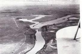
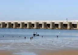
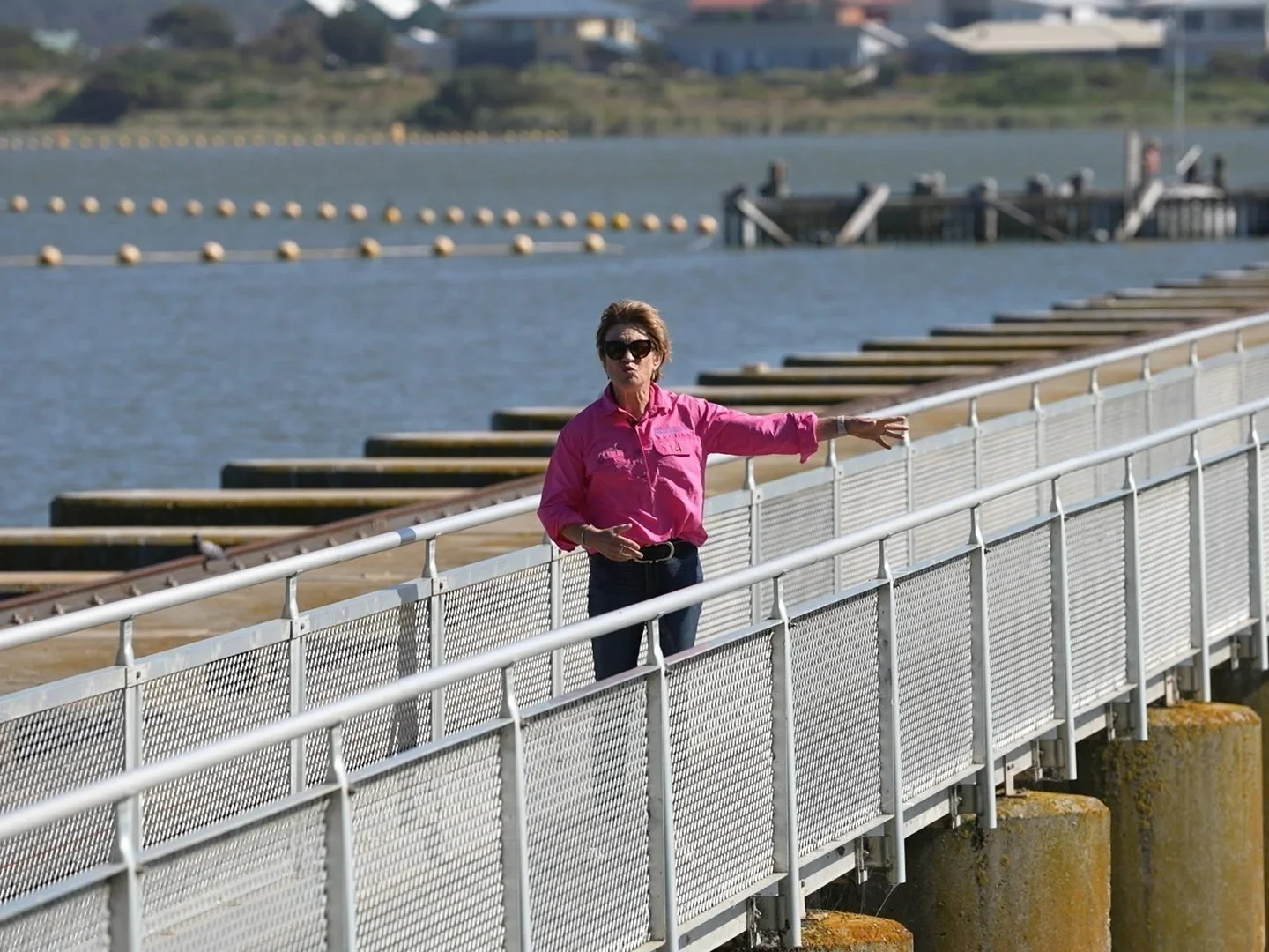
1935–1940
Construction of 7.6 km of barrages across Lake Alexandrina’s outlets transforms the Lower Lakes from an estuary into an artificial elevated freshwater system, raising levels by up to 1 metre and increasing volume from 1,300 GL to 1,900 GL. This restricts natural tidal mixing, reduces connectivity to the Coorong, and shifts reliance to Murray flows for flushing while drainage continues to diminish southern aquifer inputs. Bourman et al. (2000) note barrage construction reduced the tidal prism by 90%.
1974
Floods force barrage openings; ocean water intrudes into Lake Alexandrina, again demonstrating the system’s sensitivity to artificial controls.
2010
Floods again show ocean intrusion into Lake Alexandrina when barrages are opened.
2014–2022
The South East Coorong Restoration Flows Project is initiated, with approximately $60 million invested in attempts to address declining ecological conditions.